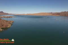
Bill Williams River is a 46.3-mile-long river in west-central Arizona where it, along with its tributary, the Santa Maria River, form the boundary between Mohave County to the north and La Paz County to the south.
Unlike most rivers in Arizona, the Bill Williams runs east to west across the landscape. Ecologically, the river serves an important function as a wildlife corridor. It allows wildlife to travel across the desert landscape expanding their range and establishing new territories. For centuries it has served humans in the same way, allowing Native Americans and many others to travel across the otherwise hostile environment.
Formed by the confluence of the Big Sandy and Santa Maria rivers—just upstream of Alamo Lake – the Bill Williams River in western Arizona flows approximately 45 miles to the Colorado River. Its watershed contains an area larger than the state of Connecticut. Year-round flows on the three rivers and their tributaries support long, continuous strips of cottonwood, willow and mesquite woodlands that are home to a wide array of wildlife, including more than 350 species of birds.


